Sunday 21 December 2008

Spiral Jetty

Spiral Jetty is an earthwork constructed by artist, Robert Smithson in 1970.


It's on the North shore of the Great Salt Lake in Utah should you wish to visit it.

This is the sort of thing that Smithson did. Big land sculptures. He died in a helicopter accident while overflying potential sites for a future piece.

And while I'm about it, see this geoglyph ?


It's called the Marree Man and is a modern land sculpture in a similar vein to antique works like the Cerna Abbas giant. Nobody knows who made it, but it was discovered from the air in 1998.

9 years later, photographs were taken for google earth. It's faded slightly in the decade since it's discovery.

Thursday 18 December 2008

From the I.T. Department


A double whammy! Both of these letters hail from East Anglia, England. If they'd both been fields, they'd have been too similar in concept, location and time of finding and I wouldn't have used one of them. But since one of them is a big pile of rocks to stop Norfolk becoming part of the North Sea, (coastal erosion is a big problem in parts of Eastern England) I'm happy to put them both in.

The I: 52°47'19.42"N, 1°36'38.39"E

The t: 52°18'48.87"N, 1° 4'40.56"E

abcdefghijklmnopqrstuvwxyz
ABCDEFGHIJKLMNOPQRSTUVWXYZ
1234567890

The I opens a whole load of potential words that I could now say with letters. But I'm still nowhere near being able to say the word "BANJO".

Still, only 4 to go now, and I have a B in the pipeline.

Yo!

Hangin'with my homies... In East Anglia.


There's loads of these *fields that look like grafitti* things around. I'm musing about them a bit but can't think of much to say about it right now. Maybe some future post...

Wednesday 17 December 2008

Piers Morgan

I got a new camera for my birthday, and a pair of walking shoes.

So off we went to use them, and we ended up in Llandudno.


We climbed part way up the Great Orme, and had a nice meal at a local Caff before returning home.

I had a look at Llandudno and the Orme on Google Earth and found that we could have gone on a spectacular drive around the entire edifice.


I also found that Llandudno pier has it's own Googe Earth wikipedia entry. This differs slightly from the standard wikipedia entry for Llandudno pier because it contains the following paragraph...

On visiting the pier former News of the World editor Piers Morgan said his mother named him due to her love of piers in particular Llandundo Pier, which she described as being long and thin, something which the many lovers of Piers Morgan have described him as.
How delightfully bizarre. I tend to think of Piers Morgan as being something else that's long and thin that also begins with the letter "P"

41

It's my birthday! I'm no longer a sleek and athletic 40 year old. I'm now a flabby and wrinkled 41.

Hooray I suppose.

Tuesday 16 December 2008

crap camp site

I stayed in this campsite once, 20 years ago.


The tent ended up full of wasps, I got the shit kicked out of me by "The biggest piss-head in Oswestry" and the owner of the site was a right old money-grabbing battleaxe.

Of course, she couldn't have predicted that the internet would come along and allow me to diss her site to the whole damn world, but it did, and so I can. And I have. So there.

In fairness to her and to the wasps (it wasn't their fault) I haven't told you where this campsite actually is. If you choose to look at the coordinates and work it out for yourself, well that's your business. The Wales tag may help you narrow your search somewhat, if that helps.

Just for the hell of it

I'm going to hotlink to a random google earth picture because I'm getting bored with The Face of Evil.


Sunset at Bikoro

Almost exactly on the Equator, in the middle of Africa, in the Democratic Republic of Congo; this photo shows sunset at Lake Tumba. Being random, it could have been a really crap pic, but I think the colours and composition are lovely. The photographer is zhoufengjing

Saturday 13 December 2008

the face of evil!


freaky!

If you want to know exactly where it is, click on the pic and the coordinates will be visible in the bottom left corner. I'm not generally going to post kmz's for every single thing, but this gives people a way of looking at these things in context without me having to bother.

Huzzah!

Friday 12 December 2008

A change of scene and the sight of the finishing line

So first of all, I made a conscious effort to go look at New Zealand. Funny how it got overlooked, but I'm glad I had a gander at it.

Secondly, these upper case letters are treading on each other's heels to be found right now. I can only surmise that the prospect of mopping up those last elusive examples is appealing to me, and that the positive frame of mind is aiding my quest.

Ah, the power of positive thinking!

The reason for my optimistic exuberance?

K. As in the letter. Here: 46°26'22.21"S, 168°21'20.96"E

Someone suggested using the island of Celebes, in the Indian Ocean, but I wasn't truly happy with it's K'ness.

Ach. I'm off to see someone I've only ever met on a discussion board today. Gotta go in a few minutes. To Shropshire no less. So I'll post a pic and go pack my trunk.

'K?


Well I went and I met Artist, Nick Raybould and he bought me lunch, which I think deserves a link to his website.


abcdefghijklmnopqrstuvwxyz
ABCDEFGHIJKLMNOPQRSTUVWXYZ
1234567890

An R! Yay! - With a flourish! Hmmmm...


I wanted to find a letter in New Zealand, because I had nothing from there at all.
Mainly I was looking for an I, but this R jumped out at me from
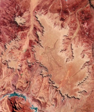
40°22'21.65"S, 175°33'54.17"E. It's a bit amorphous comapared to some, and that tail kind of goes against what I've set myself to do, but I've struggled to find anything R-like, so this is definately going in.

abcdefghijklmnopqrstuvwxyz
ABCDEFGHIJKLMNOPQRSTUVWXYZ
1234567890

Thursday 11 December 2008

A... Joint of some description.

I wonder if someone will read this because they're looking for something cannabis related? Perhaps months or years after this has been written, someone will see the title and have a read.

Well sorry to disappoint you. I came across a knobbly island that could be used as a knee or ankle or elbow or something.

It's the island of Grand Comore, in the Indian Ocean, off the coast of Africa and here's what it looks like.


or it could be a sock, I suppose.

If I'm going to make things out of planet in this way, there are limits to what can be done using blogger. These images will get merged into something else using some graphics application outside of here. I can resize, rotate, cut and paste things other than rectangles, etc, and produce composite forms as a single image. Still got only quite a rough idea of what I'm trying to do here, but I'm sure it will develop into something.

P


This one's in Liverpool.


This one was on my hard disk. Dunno where it was from now. I think the first one is better.

It's precise location is 53°24'13.29"N, 2°58'4.66"W - just by the Catholic Cathedral. Also known as the Mersey Funnel or Paddy's wigwam.

abcdefghijklmnopqrstuvwxyz
ABCDEFGHIJKLMNOPQRSTUVWXYZ
1234567890

The middle of the Atlantic Ocean


That's what it looks like.

Russian Agriculture

That thing in Denmark? The fields radiating away from the villages?

I think if we'd had satellites, 1000 years ago we'd have seen Denmark looking something like this:


Things are a bit more spread out in Russia than they are in Denmark. Left to its own devices, the land reverts to woodland. Same principle. Develop closest first. I'm just stating the obvious I suppose, but I like the way it's so easy to see.

Wednesday 10 December 2008

It's a fist!

In a green glove. I wonder if there are any other body parts out there? I have a couple of smiley faces and a fist. I could make people out of places!


This one is in Syktyvkar, Russia, so I should give it a big red flag or a hammer and sickle to hold.


Up the workers! Gggggrrrraaaggghhhh!!!

Fields and Agriculture

One thing that caught my eye was the US mid-west. The reason it caught my attention was because of its' incredible regularity. The reason it's regularity was startling was because I'm used to seeing the land as a patchwork of irregularly sized and shaped fields.

Here's a random part of rural England, from about 20,000 feet up.

See what I mean? It's a jigsaw of interlocking field boundaries that follow and adapt to the contours of the land.

I suppose this tells a story of a land that's owned by lots of individuals who have carved things up, sold and bought little bits to each other, etc. But it was never really a blank canvas. Not for millenia. If I wanted to make a road or a fence, I had to take into account what was already there.

But the US is a different kettle of fish.

This picture is taken from about the same height above ground level.

Notice how regular it all is? It's arranged on a grid pattern, aligned to the cardinal points (the verticals go north-south, the horizontals go east-west) and it goes on and on for miles and miles and miles in every direction. Within those squares, there is some variety, but not to anything like the same degree that you'd find in England, or for that matter, Europe, where strip fields seem to be more in vogue.

Also, irrigation is much in evidence. Take a big square, put a squirty thing in the middle of it, and you end up with a big square with a nice fertile circle in the middle of it.

Like this bit, taken from about 20,000 feet above the ground in Colorado:


Equally this must tell a tale. Take a land and colonise it and you get to put a pragmatic and efficient structure in place. The people that built America didn't have the same constraints as people in Europe, and this is the result.

I do have more to write on this post, covering Europe and the rest of the world. I'm not an agriculture expert. I just find the differences interesting. Once spotted, you really can't miss the patterns.

Finally, here's an equally startling (in it's own way) pattern of fields from Denmark. I can't find the particular one I was looking for, but again, a discernable pattern exists. In this case, the fields radiate out from the villages, like the rays of the sun or the spokes of a wheel. Blame the vikings for that one. Forever messin' around on bikes, the buggers.

Tuesday 9 December 2008

M

This M is in a field just south of Carlisle.

54°49'47.91"N, 2°54'1.26"W


Imagine! Back in 2003, some bloke with a tractor had the foresight to know I was going to embark on this pointless project and went round and round in a field until he'd made a stylised "M" that could be seen from the air! Thank you, Man on tractor. A packet of M and M's is winging its way through the postal system even as I type this.

abcdefghijklmnopqrstuvwxyz
ABCDEFGHIJKLMNOPQRSTUVWXYZ
1234567890

Finding those two letters in such a short space of time has really given me a boost. Suddenly the upper case alphabet has only 8 letters to go, and one of them is the letter "I" which will be easy. I suspect that "K" and "R" will be the hardest, but we shall see...

From frolics to frostbite

Bit of a contrast, but of course, somewhere or other on Earth, it's every time of day, and every season of the year (well sort of)

I've not spent a lot of time looking at Iceland. Fascinating country, of course. One place I'd love to actually visit at some point. But most of Google Earth's coverage of Iceland is satellite rather than aerial, and it's magnificent scenery is transformed into an amorphous hodge-podge of gaudy colours.

Reykjavik, though, is rendered in much higher quality, as befits the most northerly capital city in the world.

And so it is that I found an F in the land of fire and frost.


Not the most distinct of letters, but much harder to locate than I'd anticipated.

64° 3'47.38"N, 21°57'16.57"W

abcdefghijklmnopqrstuvwxyz
ABCDEFGHIJKLMNOPQRSTUVWXYZ
1234567890

Sunday 7 December 2008

Cast ne'er a clout...


This picture was taken from a spherical panorama entitled "The Big Bikini Exhibition". See the whole thing here.

The long cold winter and equally long dull spring make Moscovites thirsty for sunlight. Thanks to the extremely hot last week of May it was possible to sunbath without the risk of frostbite.

This popular beach is located in Serebryany Bor (Silver Pine tree Forest), an artificial island formed by the loop of Moscow river and the straightening boat channel.


So there you go. Always nice to put a bit of colour on this blog.


Saturday 6 December 2008

Taxi?


Never one around when you need one...

I might have found myself.

See this?


This:

53°26'4.23"N, 3° 4'13.05"W is how the New Brighton Promenade area looks from above.

The road just above the row of houses is a road that runs parallel to the prom. Sometimes, the tide breaks over the sea wall, and the prom is closed. Then the road acts as a relief road, and can be fairly busy. Usually though, the bulk of the traffic just goes on a big long straight run along the prom. Then Coastal Drive, as it is called, becomes a nice open and quiet bit of road, with a couple of easy roundabouts and nice wide tarmac. Ideal for learners. I spend a lot of time in such places. Especially with people who have only just started to learn.

There are two learner vehicles (with roof signs) just above the white car in the middle of the screen. Back in 2005, I was teaching in a black Peugeot 206. So it's just possible that I'm sat in that black car with the white speck on its roof. Tell you what? I'll zoom in a bit closer.


Can you see me?

I have blue eyes and probably needed a shave, if that helps.

I'm still in a black car, but now I work for myself. If you're looking to learn to drive, in Wallasey or Birkenhead, or Wirral or anything, and you're particularly keen on learning in a black car, well I'm yer man!

Friday 5 December 2008

De do doh dont de doh?

a? a? a? a? a? a? a? a?

There's a lower case "a" close to Liverpool airport. Y' know worra mean, like?

I nearly crashed into it. That's how I know. See previous post.

Liverpool airport is on the outskirts of, well, Liverpool...

53°21'36.29"N, 2°48'26.53"W


abcdefghijklmnopqrstuvwxyz
ABCDEFGHIJKLMNOPQRSTUVWXYZ
1234567890


Driving lessons Wallasey driving lessons wirral learn to drive school of motoring birkenhead